Hydrological restoration through drain removal, ditch infill, and reduced water abstraction in Chaamse Beken, Netherlands
Sponge Scapes case study NL 01
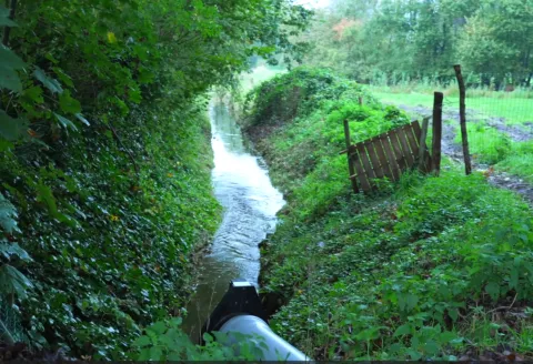
The Chaamse beken area is part of the Northern Temperate Atlantic ecological region which streches from southwestern and northern France, Belgium, the Netherlands, northwestern Germany and western Denmark. Most of the region's forests have been converted to fields or pastures, and its once-extensive wetlands have mostly been drained and filled for agriculture, as is the case in Chaamse Beken. For this case study, the sponge function is mainly based on the management of aquifer/groundwater recharge. Local stakeholders are particularly interested in the possibilities to prevent/reduce floods and droughts due to previous extreme events in the area. For this case study, long-term data and high-end groundwater and surface water modeling tools are already in place to assess the overall sponge function potential of this area.


Overview
| Authority type | Authority name | Authority role | Authority responsibility |
|---|---|---|---|
| Regional / sub-national water authority | Water Authority Brabanse Delta | Monitoring | Responsible |
Site Information
Design and Implementation
Policy and Governance
Impacts and Monitoring
Monitoring System
Type of sponge measures: Removing drains, reducing depth of ditches and streams, increasing surface water levels, reducing irrigation abstraction from groundwater and surface water.
Impact Assessment Methodology
Socio-economic Impacts
Runoff attenuation: Reduce flow peaks by reducing surface drainage, Hydraulic modelling (Delft3D FM 1D2D)
Peak flow reduction: Reduce flow peaks by reducing surface drainage, Hydraulic modelling (Delft3D FM 1D2D)
Groundwater recharge: Increase (summer) groundwater levels, Groundwater modelling (MODFLOW-MetaSWAP)
Increase crop production: Minimize impact of wetter landscapes on crop production, Ecohydrological modelling (Waterwijzer landbouw)
Create/restore Terrestrial Habitat: Increase suitability for groundwater dependent ecosystems, Ecohydrological modelling (Waterwijzer natuur)
Avoid or reduce negative impact on crop production (flood and drought losses)
Avoid increase of downstream flood risk resulting from sponge measures