Climate adaptation with Nature-based Solutions in the Aa of Weerijs catchment
The Aa of Weerijs pilot tests how Nature-based Solutions can build drought resilience in a flat, sandy catchment between Flanders and Noord-Brabant. Led by IHE Delft within the EIFFEL H2020 program from 2021 to 2024, partners include Open University, the Province of Noord-Brabant and Water Board Brabantse Delta. The team co-designed a decision-support web app to compare options and support planning.
Models combine GEOSS and local datasets with KNMI’23 climate scenarios. KPIs track surface water availability, groundwater availability and soil moisture. Provincial opportunity maps and green-blue policy zones steer siting where benefits and feasibility align.
The strategies assessed cover ditch blocking, infiltration ponds, wetland restoration, heathland restoration, brook bed barriers and tree planting. Results indicate the strongest gains for groundwater and soil moisture from ditch blocking, infiltration ponds and heathland restoration. Wetland restoration and brook bed barriers show mixed performance across subareas. Tree planting often reduces drought indicators in some locations due to higher evapotranspiration.
Outputs include prioritised maps, combined strategies aligned with policy zones and agricultural areas, and a transparent web interface used in workshops. No physical works were built within the project window. The package readies local actors for investment and monitoring. The pilot links WFD objectives with provincial nature and water policies, including the Nature Management Plan and Green-Blue values layer, to scale NBS where they deliver multiple benefits. Cross-border hydrological controls, canalised networks and competing water uses remain constraints. Key lesson: in sandy lowland basins, infiltration-focused measures outperform planting for hydrological drought resilience. The toolset persists beyond the grant to support implementation and monitoring.
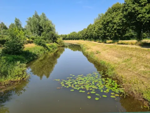
Overview
Assess soil carbon co-benefits for selected NBS
Support co-design and decision-making with a web application.
| Authority type | Authority name | Authority role | Comments | Authority responsibility |
|---|---|---|---|---|
| Research institute / University | IHE Delft Institute for Water Education | Determination of design details of the measure | hydrological modelling and decision app | Responsible |
| Regional / sub-national water authority | Province of Noord-Brabant | Other | policy links and opportunity maps | Responsible |
| Regional / sub-national water authority | Water Board Brabantse Delta | Other | data and advice | Supporting |
| Architects / Engineers | KNMI | Determination of design details of the measure | climate scenarios | Supporting |
Site Information
Design and Implementation
Use of GEOSS and local data in an integrated surface–subsurface model
Opportunity-map-led siting of NBS
Evaluation with drought-related KPIs.
Canalised network and cross-border influences constrain control on low flows and water tables.
Financing
Policy and Governance
| Wider plan focus | Name | Comments |
|---|---|---|
| Climate adaptation | EIFFEL Project | Earth Observation applications for climate change adaptation & mitigation |
| Activity stage | Activity type |
|---|---|
| Screening phase | Workshops and consultations with province and water board using the pilot web application interface. |
Impacts and Monitoring
Monitoring System
Hydrological model calibrated and validated with GEOSS and local data
KPIs include surface water availability, groundwater availability and soil moisture index
Climate forcing from KNMI’23 scenarios.
Maintenance
Socio-economic Impacts
Biophysical impacts: Hydrology
Best performance on groundwater and soil moisture from ditch blocking, infiltration ponds and heathland restoration
Tree planting produced negative effects in several sections due to higher evapotranspiration
Wetland restoration and brook bed barriers showed mixed effects across sub-areas.
Lessons Learned
Evaluate combined strategies across policy-defined zones to scale up effects
Tree planting can worsen drought metrics in some sub-catchments.
| Driver type | Driver role | Comments |
|---|---|---|
| Availability of subsidies | Main driver | EU funding |
| Success factor type | Success factor role | Comments |
|---|---|---|
| Existing staff and consultant knowledge | Main factor | robust modelling tools, existing opportunity maps and provincial policy frameworks |
| Attitude of relevant stakeholders | Main factor | Active role of province and water board in co-design |