
Summary
Órbigo River (Duero Basin, NW Spain) ecological status improvement. A bundle of sponge measures - levee removal/set-back, rip-rap removal, recovery of secondary channels, floodplain reconnection, natural bank stabilisation, and riparian buffer restoration - was implemented under the WFD and Floods Directive; the project was a 2013 IRF European Riverprize finalist.
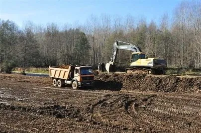
Section I (upper ~23.5 km) was built in 2011–2013: ≈4.72 km of rip-rap and 8.71 km of levees were removed, 3.13 km set back, ~10 km of side channels reopened, and ~300 ha of floodplain reconnected; limited works followed in Sections II–III. The Alcoba weir was modified by cutting a central notch (~15–16 m) with seasonal removable boards and a ramp to restore fish passage and sediment/nutrient continuity, reconnecting ~25 km of river.
Post-project assessments report increased channel dynamism and sinuosity and riparian vegetation regeneration - moderate effectiveness in the short term, underscoring the need for long-term monitoring. Overall, actions improved lateral and longitudinal connectivity and enhanced natural flood attenuation; AdapteCCa summarises ~480 ha of floodplain now functioning with the river.
Photo gallery


Overview
| Authority type | Authority name | Authority role | Comments | Authority responsibility |
|---|---|---|---|---|
| National water authority | Ministry of Environment and Rural and Marine Affairs (Ministerio de Medio Ambiente, Medio Rural y Marino), MARM | Initiation of the measure | Providing a general framework (drawing up the National Strategy on River Restoration, ENRR) in which this initiative can take place) | Responsible |
| Regional / sub-national water authority | River Basin Authority (Confederación Hidrográfica del Duero) | Determination of design details of the measure | Selecting a candidate project to be developed within the framework of the National Strategy on River Restoration. Selection criteria based on IMPRESS, Methodological Guide on River Restoration and priority areas aimed at improving connectivity | Responsible |
| Regional / sub-national water authority | River Basin Authority (Confederación Hidrográfica del Duero) | Implementation | Preparatory, diagnosis, public hearing process and works | Responsible |
| National water authority | Ministry of Environment and Rural and Marine Affairs (Ministerio de Medio Ambiente, Medio Rural y Marino), MARM | Implementation | Participation during preparatory, diagnosis, public hearing process and works | Responsible |
| Other | Municipalities (Ayuntamientos): Cimanes del Tejar, Llamas de la Ribera, Carrizo de la Ribera, Turcia and Santa María del Rey | Implementation | Participation during preparatory, diagnosis and public hearing process | Supporting |
| Other | Local entity (Juntas vecinales) | Implementation | Participation during preparatory, diagnosis and public hearing process | Supporting |
| NGO | Neighbourhood associations | Implementation | Participation during preparatory, diagnosis and public hearing process | Supporting |
| National water authority | Ministry of Environment and Rural and Marine Affairs (Ministerio de Medio Ambiente, Medio Rural y Marino), MARM | Financing | Within the framework of the National Strategy on River Restoration | Supporting |
| Regional / sub-national water authority | River Basin Authority (Confederación Hidrográfica del Duero) | Monitoring | — | Supporting |
Site Information
Design and Implementation
In the near future (already passed environmental and technical assessment and pending to obtain funding) similar projects will be carried out in downstream stretches (segment II: 27.5 km; and segment III: 57.8 km)
Financing
Executed budget: 2065264.81 €
Policy and Governance
Mass stabilisation and control of erosion rates.
Biodiversity and gene-pool conservation in riparia. More accurately: improve ecological status of the river.
| Directive | Relevant pressure |
|---|---|
| Floods Directive identified pressure | Natural Exceedence |
| Floods Directive identified pressure | Blockage / Restriction |
| WFD identified pressure | 4.1.1. Physical alteration of channel/bed/riparian area/shore of water body for flood protection |
| WFD identified pressure | 4.2.2. Dams, barriers and locks for flood protection |
| Directive | Relevant impact |
|---|---|
| Floods Directive identified pressure | Waterbody status (adverse permanent or long-term consequences ecological or chemical status of surface water bodies or chemical status of ground water bodies affected, as of concern under the WFD due to the hydromorphological impacts of flooding) |
| Floods Directive identified pressure | Infrastructure (adverse consequences to infrastructural assets such as utilities, power generation, transport, storage and communication) |
| Floods Directive identified pressure | Other environmental impacts: other potential permanent or long-term adverse environmental impacts, such as those on soil, biodiversity, flora and fauna, etc. |
| WFD identified pressure | Altered habitats due to morphological changes |
| WFD identified pressure | Altered habitats due to hydrological changes |
| Requirement directive | Specification |
|---|---|
| Floods Directive-mitigating Flood Risk | By means of measures aimed at giving river more space |
| WFD-achievement of good ecological status | By means of measures aimed at improving the hydromorphological conditions of the water body (river continuity and morphological conditions, mainly) |
| Wider plan type | Wider plan focus | Name | Comments |
|---|---|---|---|
| National | Water | National Strategy for River Restoration (Estrategia Nacional de Restauración de Río, ENRR) | Sub-programme 3 (improvement of the longitudinal continuity of the rivers within the Duero basin) and 4 (improvement of the lateral continuity of the rivers within the Duero basin) [Source: Rodríguez et al., 2012a] |
| Activity stage | Activity type | Key issues | Comments |
|---|---|---|---|
| Screening phase | — | Preparatory phase (year 2009): with municipal majors/neighbourhood associations'representatives. Using ortophotos (years 56-57, 2004 and 2008) as a basis for analysing changes in floodplain | — |
| Design phase | — | a) Diagnosis phase (year 2009): Compilling and analysing information provided by the referred stakeholders; b) Informative sessions: with other interested stakeholders (inhabitants) | — |
| Other | — | Public hearing phase (year 2009: alternatives were discussed and showed by means of computer simulation on the basis of ortophotos (years 2004 and 2008). | [CHD, 2013b]: More than 50 meetings (in a period of 3 years) with stakeholders. |
| Other | — | Monitoring | [Source: Barquero and Santillán (2012a)] |
| Design phase | — | Informative sessions (for stakeholder (inhabitants) | — |
| Implementation phase | — | a) Informative sessions (for stakeholder (inhabitants); b) Dissemination activities (for external audience) and field trips: Riverbasin Authority/Ministry of Environnment Websites; Specialised national/international networks on river restoration (newsletters, presentations). 2013 IRF European Riverprize finalist practice.Field trips from: Universities, Administration bodies, within in the framework of specialised workshop; c) Newspapers; d) Volunteering and environmental education programme | — |
| Screening phase | CONSULTATION ACTIVITIES | Preparatory phase (year 2009): with municipal majors/neighbourhood associations'representatives. Using ortophotos (years 56-57, 2004 and 2008) as a basis for analysing changes in floodplain | — |
| Design phase | CONSULTATION ACTIVITIES | a) Diagnosis phase (year 2009): Compilling and analysing information provided by the referred stakeholders; b) Informative sessions: with other interested stakeholders (inhabitants) | — |
| Other | CONSULTATION ACTIVITIES | Public hearing phase (year 2009: alternatives were discussed and showed by means of computer simulation on the basis of ortophotos (years 2004 and 2008). | [CHD, 2013b]: More than 50 meetings (in a period of 3 years) with stakeholders. |
| Other | CONSULTATION ACTIVITIES | Monitoring | [Source: Barquero and Santillán (2012a)] |
| Design phase | COMMUNICATION | Informative sessions (for stakeholder (inhabitants) | — |
| Implementation phase | COMMUNICATION | a) Informative sessions (for stakeholder (inhabitants); b) Dissemination activities (for external audience) and field trips: Riverbasin Authority/Ministry of Environnment Websites; Specialised national/international networks on river restoration (newsletters, presentations). 2013 IRF European Riverprize finalist practice.Field trips from: Universities, Administration bodies, within in the framework of specialised workshop; c) Newspapers; d) Volunteering and environmental education programme | — |
Impacts and Monitoring
Monitoring System
Maintenance
Impact Assessment Methodology
Socio-economic Impacts
Recognition as climate adaptation good practice
Biophysical impacts: Hydrology
Biophysical impacts: Biodiversity
Biophysical impacts: Water & Soil Quality
Biophysical impacts: Others
Lessons Learned
a) Good practice of integrated water management and land use policies
b) Implementation of innovative concepts (e.g. “room for the river”, green infrastructure…)
c) Relevance of management and planning tasks.
d) Example of integrated approach in WFD and FD implementation
e) Example of the need to devote a great deal of time and effort to explain to the stakeholders the scope of the measures in order to achieve their acceptance and their participation. Multiplier effects are obtained when stakeholders became aware of the effectiveness of the measures.
e) Example of the relevance of public involvement during the whole process (public participation during the planning cycle and volunteering within the framework of environmental programme linked to the Project).
f) Impact on the media (beyond the pressnotes on the plan).
g) Replicability (downstream stretches) potential and networking potential (the project derived in the participation of the Basin Authority -together with other 4 European basin authorities- in the ECRR Community of Practice -launched in 2013 as a network for sharing their experiences in river restoration).
| Driver type | Driver role |
|---|---|
| Past flooding events | Main driver |
| Organisation committed to it | Main driver |
| Success factor type | Success factor role | Comments |
|---|---|---|
| Public participation | Main factor | Active participation process during the whole life-cycle of the project |
| Attitude of decision makers | Main factor | Innovative approach, strong involvement and will to promote participation |
| Existing staff and consultant knowledge | Main factor | Innovative approach, strong involvement and will to promote participation |
| Existing institutional framework | Main factor | Coordination between Ministry and River Basin Authority |
| Financing possibilities | Main factor | — |