
Summary
The Ernz Blanche (Luxembourg) river restoration sought to undo channelisation that had uniformised the river and increased downstream flooding. It relocated the watercourse into the thalweg, widened and/or raised the bed, re-meandered the channel, backfilled the former bed, restored adjacent streams, redesigned pipeline connections, and redeveloped areas around hydraulic structures.
After the 2002 feasibility, major works were delivered in 2010–2011 on the Koedange–Supp reach (~5 km), reducing flood peaks at Larochette (–3.8 m³/s; –25 cm) and creating ~110,000 m³ of storage (project cost ≈ €1.52 m). In 2016, longitudinal continuity downstream at Ernzen was restored via a pool-type fish pass at Wehnschelt and a rough ramp at Milleboesch. The project area has also been tied into the PC5 cycle path and Natura 2000 management.
Under Luxembourg’s 2021–2027 Flood Risk Management Plan, additional riverbed restoration and space-for-river measures are listed/advancing on several reaches, incl. 417 m at Larochette; 1,102 m along CR119 at Ernzen (in implementation); 2,739 m at Altlinster; and 629 m at Medernach. Recent 2025 decisions cover local flood-protection works and targeted sediment removal in Larochette, while continuous hydrometric monitoring at station “Larochette / Ernz Blanche” supports ongoing management.
Photo gallery
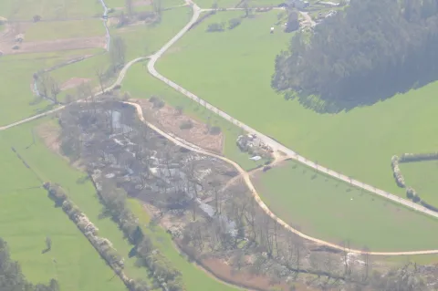

Overview
Create ~110,000 m³ flood storage; reduce Q10 peak from 18.8 → 15 m³/s.
Restore adjacent streams & hydraulic structures; improve continuity.
| Authority type | Authority name | Authority role | Comments | Authority responsibility |
|---|---|---|---|---|
| Local water authority | Municipality of Fischbach | Initiation of the measure | Project owner | Responsible |
| Local water authority | Municipality of Heffingen | Implementation | Project owner | Responsible |
| Local water authority | Municipality of Larochette | Initiation of the measure | Project owner | Responsible |
| Other | Department of Roads and Bridges | Initiation of the measure | Project owner | Responsible |
| National water authority | Ministry of Sustainable Development and Infrastructure | Other | — | Supporting |
| National water authority | Water Management Administration | Other | — | Supporting |
| Other | Ministry of middle classes and tourism | Other | — | Supporting |
| Architects / Engineers | Micha Bunusevac design office | Determination of design details of the measure | — | Responsible |
| Architects / Engineers | Kisch S.A. | Implementation | Operator | Responsible |
Site Information
Design and Implementation
Connectivity: subsequent fish-pass works at barriers (e.g., Hessemillen, Bakesmillen, Neimillen, “am obersten Deich”).
Financing
Policy and Governance
The overall flood risk is due to urbanisation and the river canalisation upstream from Larochette, as well as river realignments.