
Résumé
The study site is the sub catchment of Tetves, is considered a priority area in terms of water protection. The size of the study site is 68 km2. 49% of the total catchment area is forest, 39% is arable land, 1% orchards, 1% vineyard, 1% is grassland and 2% is urban.
The study site is sensitive to nutrient and nitrate loss. Extreme weather events, the presence of loose parent material and a lack of best management practices in some part of the study site increase soil degradation, especially gully erosion. The water and nutrient management of this small catchment affects water quantity and quality of Lake Balaton. Extreme weather events will increase the environmental and social conflicts in the region.
The most pressing issues recognized in the study site are: revise the aspects considered for the delineation of soil erosion prone areas, wider application of measures that efficiently decrease soil erosion and nutrient load, and implementation of integrated water resources conservation.
OPTAIN project aims to identify effective combination of the NSWRMs and optimize their allocation, in order to improve water and nutrient retention in the soil and the catchments. Emphasis will be put on suitable options to foster the resilience of agricultural production to climate change.
Photo gallery
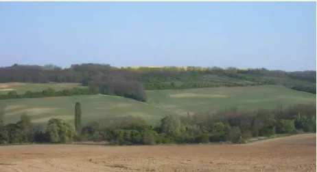

Vue d'ensemble
Site Information
Design and Implementation
Financing
Policy and Governance
In order to change land management practices on landscapes within the watershed the following stakeholders will be involved in the development and implementation of the project: General Directorate of Water Management, Local farmers, Balaton Limnological Institute, Lake Balaton Development Council, Hungarian Young Farmers Association (AGRYA), Hungarian Chamber of Agriculture (NAK), AGRO PROFI, and WWF Hungary.
Impacts and Monitoring
No information provided for this section.
Lessons Learned
No information provided for this section.
Sources
No information provided for this section.