
Summary
The project’s objective was to improve the conservation status of aquatic bird species in Lower Prut Floodplain Natural Park (Galați County, RO) through scientific inventory, monitoring, site restoration, awareness-raising, implementation of the park management plan, and the designation of Natura 2000 SPAs. Partners were the University of Bucharest, the Romanian Ornithological Society and Romsilva – Galați Forestry.
At Mața-Rădeanu, dykes were rebuilt to restore hydraulic control: a 1,800 m dyke separating Mața (Galați) from Cârja (Vaslui) and a 3,600 m dyke subdividing Mața; a birdwatching tower serves the complex. The area falls in SPA ROSPA0130 Mața-Cârja-Rădeanu and functions today as a large fish-farming/recreational fishing complex managed locally by AJVPS Galați; recent county risk documentation lists “Amenajarea Piscicolă Mața-Rădeanu.” In 2024, local press reported drought-related low water affecting this complex.
Photo gallery
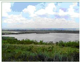


Overview
Re-establish the ecological balance of lakes by fixing degraded hydrological structures and improving/maintaining water levels.
Designate four SPAs (Romanian Natura 2000) and prepare/approve an integrated park management plan and administration.
Carry out inventories and monitoring, plus public engagement (village consultations, picture books, nature trails, six annual environment days, bird-watching towers).
Rehabilitate dykes to manage water levels: 1,800 m boundary dyke (Mața–Cârja) and 3,600 m internal dyke subdividing Mața.
| Authority type | Authority name | Authority role |
|---|---|---|
| Regional / sub-national water authority | Regional Environmental Protection Agency Galati | Monitoring |
| Other | County Council Galati | Initiation of the measure |
| Other | University of Bucharest, Research Center for Environment and Impact Studies | Determination of design details of the measure |
| NGO | Romanian Ornithological Society | Monitoring |
| Other | Forestry Department Galati | Determination of design details of the measure |
| Other | Park Administration Lower Prut Floodplain | Determination of design details of the measure |
Site Information
Design and Implementation
Financing
Policy and Governance
| Wider plan type | Wider plan focus | Name |
|---|---|---|
| National | Environment & Biodiversity | Lower Danube Green Corridor programme |
| Activity stage | Activity type | Key issues |
|---|---|---|
| Implementation phase | Awareness raising activities | These include information dissemination, consultation of every village in the area, and active participation and education with local educational material to be produced. The project takes into account that there is a relatively high illiteracy in the area and will address stakeholders in wide variety of ways, including picture books, nature trails, six annual environment days with expeditions into the area, children's exhibitions, and bird watching towers |
Impacts and Monitoring
Monitoring System
Maintenance
Socio-economic Impacts
Active fish-farming/recreational fishing platform (~607 ha, AJVPS), with generic tourism/recreation benefits from the restoration.
Biophysical impacts: Hydrology
Biophysical impacts: Biodiversity
Biophysical impacts: Water & Soil Quality
Lessons Learned
| Success factor type | Success factor role | Comments |
|---|---|---|
| Attitude of decision makers | Main factor | Clear technical leadership/roles (County Council initiation; design inputs from Park Admin, Forestry Dept., University; monitoring by REPA Galați and SOR). |
| Financing possibilities | Main factor | Financing mix: EU LIFE+, national, county. |
| Communication activities | Secondary factor | Park-wide communication and education measures that supported uptake. |