
Summary
Dotnuvėlė river basin covers 192.7 km2. Four reservoirs are situated in the area: near Mantviliškis, Akademija, Dotnuva and near Kėdainiai. The Dotnuvėlė basin is in the Central Lowlands of Lithuania, which is rich in moist soils. Agricultural areas account for 69.2%, forests and other natural areas for 24.5%, artificial surfaces - 5.8%, and water bodies make up only 0.5%. State river monitoring is carried out for this river. The ecological status of the Dotnuvėlė river corresponds to poor (upstream) and medium (downstream) classes.
The OPTAIN project will support the case study team with identifying and developing efficient land management strategies and small technical solutions to improve the soils’ infiltration and water holding capacities as well as its capacity to filter, buffer and transform pollutants.
Photo gallery
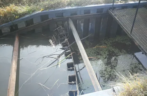
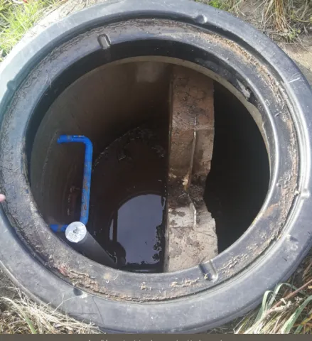
Overview
| Authority type | Authority name | Authority role | Comments | Authority responsibility |
|---|---|---|---|---|
| Architects / Engineers | UAB "Aplinkos inžinierių grupė" | Determination of design details of the measure | Under supervision of Environmental Protection Agency at the Ministry of Environment | Responsible |
| Other | Environmental Protection Agency at the Ministry of Environment | Implementation | — | Responsible |
| Architects / Engineers | UAB "Aplinkos inžinierių grupė" | Monitoring | The project team UAB "Aplinkos inžinierių grupė" is responsible for maintenance during the project period. Afterward, local farmers or community members will take over. | — |
Site Information
Design and Implementation
Financing
Policy and Governance
| Requirement directive | Specification |
|---|---|
| Water Framework Directive (WFD) 2000/60/EC | — |
| Nitrate Directive (NiD) 91/676/EEC | — |
| The Birds and Habitat Directives | Habitats Directive 92/43/EEC |
| Floods Directive-mitigating Flood Risk | — |
| Wider plan type | Wider plan focus | Name | Comments |
|---|---|---|---|
| Catchment-based | Water | EU Water Framework Directive | The artificial wetland in the Dotnuvelė River basin is part of a catchment-scale effort to reduce nutrient pollution from agricultural runoff and improve water quality in alignment with the EU Water Framework Directive. |
Impacts and Monitoring
Monitoring System
Maintenance
Lessons Learned
| Driver type | Driver role | Comments |
|---|---|---|
| Balancing different objectives | Main driver | Nutrient pollution reduction needs, water quality improvement goals |
| Success factor type | Success factor role | Comments |
|---|---|---|
| Attitude of relevant stakeholders | Main factor | Stakeholder engagement |
| Other | Main factor | Tailored design |
| Available support tools | Main factor | External funding and support |