
Restoration of the Cerny Potok stream, Czech-Republic

Summary

Summary

The Nature Conservation Agency of the Czech Republic (AOPK ČR) restored the Černý potok (Black Brook) in the Černá louka Nature Reserve (Ore Mountains, near Adolfov). Early trials began in 2001–2003; the main works in 2009–2010 (OP Environment/ERDF) went beyond in-channel fixes: shallow, meandering channels were newly excavated and reconnected to remnants of the historical course or led across alluvial meadows to reduce depth/volume, slow runoff and re-wet the peat meadows. Designed by Terén Design and built by EPS-Servis, the project reshaped ~2.5 km within the reserve and delivered c. 1,820 m of new channels, ~0.963 ha of ponds/wetland and an ~8 ha meander belt.

Post-restoration monitoring by UJEP found only very small lateral movement (≤10 cm), no significant incision, and that after 1980s straightening had shortened length by ~52% the restored reach in 2011 was ~43% longer than the straightened channel. AOPK notes continued monitoring and documented fish passage, incl. brown trout spawning. Media coverage during the 2019 drought reported the area stayed wet and ponds held water. In 2022, ČSOP with private partners extended restoration to a small tributary just outside the reserve.

Photo gallery
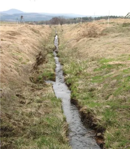
Overview
Year of issue
2025
Project
NWRM
Implementation status
Completed
Contact
Jovanka Ignjatovic, REC
Location of the project
The Cerná louka (Eng. black Meadow) is a national Reserve (NR), within the Ramsar site Krusnohorska Mountains mires at northwest Czech Republic, along the border with Germany 50°44'4" N, 13°53'26" E, 690–760 m
Country
Czechia
NUTS2 Code
Severozápad
Sponge measures implemented in the case study
Re-meandering
Stream bed re-naturalisation
Objectives
Restore natural hydromorphology: reduce the depth/volume of the straightened channel; create new, shallow meandering channels and reconnect them to relic courses or route them across alluvial meadows.
Re-establish the water regime degraded by drainage and straightening: increase retention capacity and restore natural runoff conditions/retention space in PR Černá louka.
Support biodiversity associated with wetland habitats in the reserve (Natura 2000 mire meadows).
Involved partners
Authority typeAuthority nameAuthority roleCommentsAuthority responsibility
National water authorityNature Conservation Agency of the Czech RepublicInitiation of the measureNature Conservation authorityResponsible
NGOCzech Union for Nature ConservationMonitoringNational associationSupporting
NGOLocal Chapter Teplice FergunnaMonitoringCUNC Teplice is one of hundreds of the Czech Union for Nature Conservation, which operates throughout the Czech Republic. A new activity of this organization is to create a basic land league (PS) Fergunna, whose main objective is the protection of nature and landscape of the Ore Mountains.Supporting
Site Information
Climate Zone
Cool temperate dry
Precipitation
850.00 mm
Temperature (°C)
10.00 °C
Runoff
0.02 mm
Runoff coefficient
0.25
Elevation range
713 m
Slope range
2-5%
Vegetation class
Grassland
WFD Ecological status
Poor
WFD Chemical status
Failing to achieve good
Water quality status
Cu < 0.02 mg/l Zn < 0.005 mg/l max T = 9 °C
Design and Implementation
Project scale
Meso
Project scale specifications
Cerný potok watershed (the main stream and its tributaries). In total 43,000m2 of restored marches with still or running waters
Project area
7,4
Project area specifications
Both new and restored marshes with still or running waters 43,000 m2
Area subject to Land use change or Management/Practice change (ha)
7.40 ha
Size
4.00
Size unit
km
Basis of design
Natural overflow in case of Q100 foods (along meandering segment in the alluvium) 74000 m2
Principles
The project was based on common principles of stream restoration. The main aim of the restoration was to decrease the volume of the restored streambeds especially by reducing their depth. Other important criteria included re-establishment of a natural gradient, near-natural proportions of the stream cross-section, and natural variety in current and calm ri9es
Modifications within the channelized streambed were not sufficient to respect all these criteria, therefore new streambeds were proposed and constructed. They were reconnected with the remains of the original stream course or directed freely to the alluvial meadows.
The volume of the new beds was designed at 30-day design flows (or max. one-year flows).
Factor constraints
The area of interest is an important site for many rare and endangered plants (e.g. Menyanthes trifoliata, Pinguicula vulgaris) and animals (e.g. shore-birds, amphibians) of wetlands. It was necessary to take the conservation of these species into account during the restoration works.
Constraints
The works would have to be conducted out of the nesting season of birds and metamorphosis of amphibians.
Favourable preconditions
part of Natura 2000 network
Financing
Total cost
316000.00 €
Total cost information
2001†“2003: €52,000; 2008†“2010: €264,000
Costs investment
316000.00 €
Costs investment information
2001-2003: €52,000; 2008-2010: €264,000
Financing authorities
Authority nameFinancing share
Free State of Saxony, Operational Programme Environment100 %
Compensations
No
Policy and Governance
Policy description
Comprehensive remediation of the hydrology of the area, initiation of natural, dynamic re-development of the stream channel and cessation of degradation processes in valuable habitats. These restoration measures are the main prerequisite for biodiversity protection including both stabilisation of local populations and spontaneous return of important wetland species, e.g. Snipe (Gallinago gallinago).
Also expected are flood control elements, e.g. reduction of the outflow velocity and retardation and flattening of flood waves.
Land ownership
dozens of cadastral parcels belonging to multiple ownership
Policy targets
Improved Biodiversity
Runoff control
Groundwater Recharge
Target remarks
Biodiversity and gene-pool conservation in riparian areas
Regulation of hydrological cycle and water flow
Flood control and flood risk mitigation
Policy pressure
DirectiveRelevant pressure
WFD identified pressure4.1.5 Physical alteration of channel/bed/riparian area/shore – unknown
Floods Directive identified pressureOther pressure contributing to flooding /flood risk
Other EUBirds Directive 2009/147/EC Surface drainage and peat cutting
Policy impact
DirectiveRelevant impact
WFD identified pressureAltered habitats due to hydrological changes
Floods Directive identified pressureProtected areas
Other EULoss of natural habitats and wild fauna and flora
Requirement directive
Requirement directiveSpecification
WFD-mitigation of significant pressureRestored stream sections (including adjustment of channelized streambeds and making water flow into the alluvium)
WFD-restoring a HMWBRestored meandering segment and pools with marsh habitats
Floods Directive-mitigating Flood RiskNatural overflow in case of Q100 floods
The Birds and Habitat DirectivesBoth new and restored marshes with still or running waters
Policy challenges requirements
National Wetlands Conservation Plan National Biodiversity Strategy
Part of a wider plan
No
Public consultation
Yes
Consultation activities
Activity stageActivity type
Design phaseNGOs were involved in the restoration project. Members of the Czech Union for Nature Conservation (Local Chapter Teplice †“ Fergunna) participated in study, project preparation and implementation.
Implementation phaseThe restored site is used for education, and both experts and the public from the Czech Republic and abroad have visited it.
Has contractual arrangements
No
Impacts and Monitoring

Monitoring System

Monitoring parameters
Monitoring of the restored site was supported under the transboundary project “PestrýBunt”.
The effect of restoration on the local fauna and flora was monitored as well (Nature Conservation Agency of the Czech Republic, Czech Union for Nature Conservation, Local
Chapter Teplice – Fergunna, 2007–2011)
Biodiversity,flow velocity, kind and quantity of sediments and graphic cross section profiles

Maintenance

Maintenance requirements
Maintenance activities will be focused on preservation of re-established natural conditions in the area, by the Local Chapter Teplice – Fergunna

Impact Assessment Methodology

Performance impact assessment method
Catchment outlet
Performance impact estimation information
The two dimensional hydrodynamic SRH-2D model

Socio-economic Impacts

Direct benefits information
The efect of restoration on the flow rate and delays of the flood waves, as well as on local fauna and fora was monitored as well (Nature Conservation Agency of the Czech Republic, Czech Union for Nature Conservation, Local Chapter Teplice- Fergunna 2007-2011) but only preliminary results are available at present because of a relatively short post-restoration phase.
Ancillary benefits information
The effect of restoration on the flow rate and delays of the flood waves, as well as on local fauna and fora was monitored as well (Nature Conservation Agency of the Czech Republic, Czech Union for Nature Conservation, Local Chapter Teplice - Fergunna, 2007-2011) but only preliminary results are available at present because of a relatively short post-restoration phase.

Biophysical impacts: Hydrology

Information on retained water
Dynamic meandering of the restored stream-bed is being studied, but long-term monitoring is necessary to obtain statistically significant results.
1,820 m new channels, 0.963 ha ponds/wetlands, ~8 ha meander belt; ~4.3 ha wetlands created/restored.
Post-works morphology (UJEP 2013): lateral shift ≤ 10 cm; no significant incision; after 1980s straightening (−52 % length), the restored reach was ~+43 % longer than the straightened one (measured in 2011).
The area stayed wet and ponds held water during the 2018–2019 drought.
Information on increased water storage
In a model of a restored stream section of ca. 1 km in length, the delay was up to 2 hours for the 1-year flood compared to the regulated stream and a considerable 20 minutes for a 100-year flood.
Runoff reduction
45.00
Runoff reduction unit
% Percent
Information on runoff reduction
Very significant effect was recorded on the delay of the flood wave. As a consequence, the peak flow downstream can be reduced due to delayed peak flows from the tributaries
Peak flow reduction
5.00
Peak flow reduction unit
% Percent
Information on peak flow reduction
Only a small effect of the stream restoration on the peak flow was found with the exception of less frequent floods (N1, N2 and N5 peak flows were reduced by only 50-80 l/sec)
Ecosystem water supply
0
Information on ecosystem water supply
It is not relevant for this application

Biophysical impacts: Biodiversity

Improved biodiversity
Yes
Information on improved biodiversity
The abundance of some amphibians has considerably increased in the constructed pools (e.g. hundreds of individuals of frog species, e.g. Bufo bufo, Rana temporaria, and dozens of individuals of Triturus vulgaris). A more frequent occurrence of some bird species of waterlogged meadows and marshes (such as Crex crex and Gallinago gallinago) was recorded mainly in the restored wetland habitats created by conducting small tributaries to the floodplain.
In 2011 about 20 dragonfly species were recorded. The local population of the endangered plant species Menyanthes trifoliata has increased in the floodplain.
Connectivity/biota: fish passage confirmed during brown trout spawning after restoration.

Biophysical impacts: Water & Soil Quality

Water quality overall improvements
Neutral impact-no change in WQ status
Information on water quality overall
Classified as good and very good condiions. pH = 6-8, high concentrations of dissolved oxygen.
Water quality improvements - Copper (Cu)
0.02
Water quality improvements - Copper (Cu) - Unit
mg/L
Water quality improvements - Zinc (Zn)
0.01
Water quality improvements - Zinc (Zn) - Unit
mg/L
Water quality improvements - Water Temperature (W T°)
8.00
Water quality improvements - Water Temperature (W T°) - Unit
o C
Soil quality overall improvements
Not relevant for this application
Information on soil quality overall improvements
It is not relevant for this application

Biophysical impacts: Others

Ecosystem impact climate regulation
Not relevant for the specific application
Information on ecosystem impact climate regulation
It is not relevant for this application
Lessons Learned
Key lessons
Participatory approaches to wetland restoration design were critical for Project success, which hinged on changing people’s perceptions of wetlands, and gaining the full support for restoration among authorities and stakeholders. PA Local Consultative Councils and public awareness campaigns effectively supported stakeholder involvement.
Controlled restoration is a step in the right direction and is allowing further researches and studies concerning habitat restorations.
Solid knowledge on the baseline and the desired ecosystem status should be embedded early in project design phase.
“Let-nature-work” approaches (backfilling the entrenched channel and allowing free pathfinding) can reconnect the floodplain more fully than excavating a single new channel ; documented with rapid development of multi-thread flows and wetland formation.
Early post-restoration stability with minimal incision and measured lengthening supports using shallow, meandering designs on peat meadow streams.
Drought resilience is a tangible co-benefit worth monitoring and communicating (media-visible).
Pair public funding (OP Env/AOPK) with NGO/private finance to act on private land and speed delivery.
Barriers
Barrier typeBarrier roleComments
Limited staff and consultant knowledgeMain barrierDifficulties with technical design due to insufficient national expertise in wetlands restoration
Lacking financing sourcesSecondary barrierAbsence of sustainable business cases for sustainable reed biomass utilization
Missing regulatory supportSecondary barrierNot defined target ecosystem status (favourable conservation status) at the project start.
Drivers
Driver typeDriver roleComments
Past flooding eventsMain driverRestoration of streams and their floodplains
Balancing different objectivesSecondary driverRestoration of other wetlands in the landscape
Success factors
Success factor typeSuccess factor roleComments
Specific incentives for stakeholder involvementMain factorNew methods were applied in the design of shape and course of the streambed, and their successful implementation was enabled by good collaboration between investor, designer and subcontractors.
Financing possibilitiesMain factorAvailable financing for capital investments&nbsp;
Attitude of decision makersMain factorCommitment and support provided by competent authorities&nbsp;
Attitude of relevant stakeholdersSecondary factorLocal communities and NGO involvement and support.&nbsp;
Public participationSecondary factorThe restored site is used for education, and both experts and the public from the Czech Republic and abroad have visited it&nbsp;
Flexibility / Adaptability
Adaptation to changing hydrological and habitat conditions have been achieved by a width range of structures reflecting surface, soil and geological conditions that are flexible concerning operation and further
improvement of hydraulic conditions
Transferability
Similar restoration works could be designed for other (former) wetlands along medium rivers in their low-land segments.
Basin characteristics influence
The low inclination and the plain landscape allow the achievement of relatively large flooded areas, efficient restoration of meanders and habitats reconvention with no heavy structures.
Sources